World Map › Bam
Volcano
Bam
Stratovolcano · 685 m · Papua New Guinea
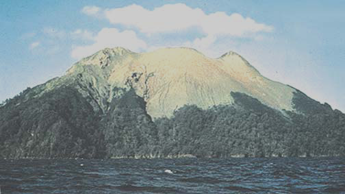
Bam sits on the South Bismarck Plate, in a subduction zone. 22 eruptions are known since the end of the last ice age, the most recent in 1960. Its major eruptions caused at least 25 deaths.
- Elevation
- 685 m
- Type
- Stratovolcano
- Tectonic Setting
- Subduction zone, continental crust
- Dominant Rock
- Andesite / Basaltic Andesite
- Plate
- South Bismarck Plate
- Country
- Papua New Guinea
- Last Eruption
- 1960
- Known Eruptions (Holocene)
- 22
- Max. Explosivity (VEI)
- 3
- Known Fatalities
- 25
Eruption Timeline
Each bar is an eruption; its height shows its explosivity (VEI 0 to 8).
Eruption Deadly Eruption (NOAA) Uncertain Date
Sources : Global Volcanism Program, 2026. Volcanoes of the World (v. 5.4.0; 7 Aug 2026), Smithsonian Institution, doi:10.5479/si.GVP.VOTW5-2026.5.4 (volcano.si.edu) · NOAA NCEI · USGS · Wikidata