World Map › Live
Live
US Wildfire Map Today. Every Active Fire, Updated Hourly
Published · Live Atlas
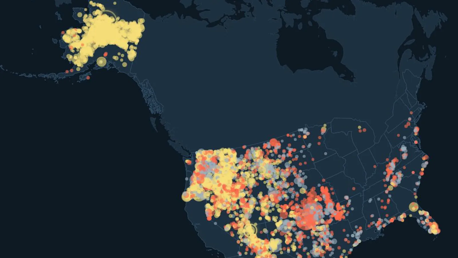
… wildfires are burning in the United States right now, … of them larger than 1,000 acres, for … acres in all, according to the National Interagency Fire Center.
Loading the latest NIFC data…
The Largest Active Wildfires
| Fire | Acres | Contained |
|---|
Active Fires by State
What the Map Shows
The orange dots on the map behind this page are fire detections from NASA satellites over the last 24 hours. A detection is a hot spot seen from space. It can be a wildfire, but also a controlled burn, a farm fire or an industrial site, so the official incident list above is the better guide.
When Is Wildfire Season?
Across the US, the largest number of big fires starts between June and August, but the season varies by region. Since 2015, Alaska has had more wildfires over 1,000 acres than any other state, ahead of California.
Where to Find Official Information
For a specific fire, the official source is InciWeb and your state's fire agency. Evacuation orders come from local authorities. For smoke and air quality, see AirNow.
Live Atlas is an information site. It does not replace official alerts or evacuation orders.
Sources
- National Interagency Fire Center, WFIGS current incidents
- NASA FIRMS, active fire detections (VIIRS)
- Live Atlas, analysis of NIFC wildfire incidents 2015–2025