World Map › Guides
Guide
The Midwest Has an Earthquake Zone Most Americans Never Heard Of
Published · Live Atlas
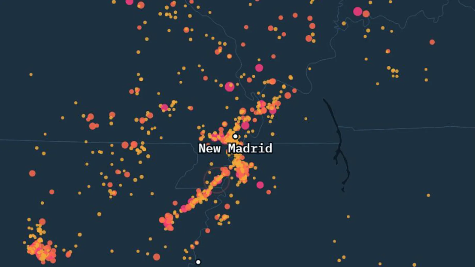
The New Madrid Seismic Zone lies where northeastern Arkansas, southeastern Missouri, northwestern Tennessee and southwestern Kentucky meet. In the winter of 1811–1812 it produced three earthquakes the USGS puts at magnitude 7.3 to 7.5, and it remains the most active earthquake area in the United States east of the Rocky Mountains.
Where Is the New Madrid Fault Line?
It is not a single fault but a set of buried faults that stretch from Marked Tree, Arkansas, to Cairo, Illinois. The zone takes its name from New Madrid, Missouri, a small river town about 100 miles north of Memphis and 150 miles south of St. Louis. Nothing marks the faults at the surface, which is one reason so few Americans know they exist.
The Winter of 1811–1812
| Date | Local time | Magnitude | Where |
|---|---|---|---|
| December 16, 1811 | about 2:15 a.m. | 7.5 | Northeast Arkansas |
| December 16, 1811 | about 7:15 a.m. | ~7.0 | The largest aftershock |
| January 23, 1812 | about 9:15 a.m. | 7.3 | Missouri |
| February 7, 1812 | about 3:45 a.m. | 7.5 | Reelfoot fault, Missouri and Tennessee |
Magnitudes preferred by the USGS for its 2014 national hazard map. There were no seismographs at the time, so estimates range from about 7 to 8.
The shaking lasted one to three minutes and woke people in New York City, Washington, D.C., and Charleston, South Carolina. The area of strong shaking was about 10 times larger than that of the 1906 San Francisco earthquake. More than 200 moderate to large aftershocks followed by mid-March 1812.
What the Quakes Did to the Land
- The Mississippi River seemed to run backward for a short time, as the ground rose and waves moved upstream.
- Reelfoot Lake, in western Tennessee, formed when the land sank and river water flooded in after the February 7 quake.
- Sand and water shot tens of feet into the air. Thousands of these sand blows still show as pale patches in farm fields.
- The town of New Madrid was destroyed. Few people lived in the region, and the USGS records one death from a falling building there.
- In 1815 Congress set aside $50,000 for the victims, the first disaster relief act in the United States.
Did Church Bells Ring in Boston?
Probably not. USGS seismologist Susan Hough traced the story to church bells in Charleston, South Carolina, likely confused with Charlestown, near Boston.
Why Earthquakes Strike the Middle of the Continent
The zone sits above the Reelfoot Rift, a deep valley bounded by faults that formed some 500 to 600 million years ago, when North America almost split apart. The leading idea is that these old buried faults are being squeezed by forces from the moving plate. The USGS says plainly that no one knows exactly what causes New Madrid earthquakes.
They also reach much farther. East of the Rockies the rock is older and denser and carries seismic waves well, so a quake can be felt over an area up to 10 times larger than one of the same size on the West Coast. In 2011 a magnitude 5.8 in Virginia was felt up to 600 miles away, while a magnitude 6.0 in Napa, California, in 2014 was felt only up to 250 miles.
Is New Madrid Still Active?
Yes. Seismometers record about 200 small earthquakes a year in the zone, most too small to feel. On our map of the wider region, 1,266 quakes reached magnitude 2.5 or more since 1974, about 23 a year over the last decade. The two strongest, both magnitude 5.2, struck in southern Illinois in 1987 and 2008, at the northern edge of the region.
Bigger ones have happened since 1812. The USGS lists a magnitude 6.0 near Marked Tree, Arkansas, in 1843, which caused damage in Memphis, and a magnitude 6.6 near Charleston, Missouri, in 1895.
Will It Happen Again?
Buried sand blows show that similar sequences struck around A.D. 900 and 1450, roughly one every 500 years. USGS estimates from the early 2000s give a 7 to 10% chance of a repeat of 1811–1812 within 50 years, and a 25 to 40% chance of a magnitude 6 or larger in the same period.
Watch the Zone Live
The map at the top of this page shows every recent earthquake. For the whole planet in the last 24 hours, see Earthquakes Today, and for the country as a whole, the United States page.
Sources
- USGS, Summary of 1811-1812 New Madrid Earthquakes Sequence
- USGS, The New Madrid Seismic Zone
- USGS, 20 Cool Facts about the New Madrid Seismic Zone (General Information Product 134, 2011)
- USGS Fact Sheet 131-02, Earthquake Hazard in the Heart of the Homeland
- USGS, East vs West Coast Earthquakes (2018)
- Central U.S. Earthquake Consortium, New Madrid Seismic Zone
- USGS, ComCat earthquake catalog (M2.5+, 1974–2026), analysis by Live Atlas